Saturday, March 1, 2014

Milford Sound on the Bike

Accompanying me on this trip were Stephen and Gavin.

For me these trips are more satisfying if there is a specific target rather than just an aimless ride, so the objective was to ride to Milford Sound in the Fiordland National Park.

I took the ferry over to Picton and from there rode down to Nelson where I stayed a couple of nights. I then met up with Stephen and Gavin and we set off down the island’s West coast staying the night in the town of Westport.

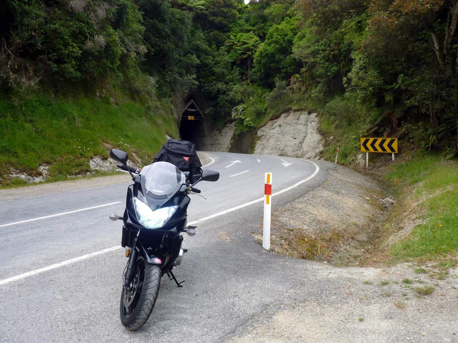
The bikes.

Camping in Westport.

The weather so far had been hot and sunny but it all turned to custard that evening when the rain arrived, though at least not until after I pitched my tent. It rained heavily all night and I had the grim task of packing up my tent in the pouring rain.

We rode all day in the rain, which made for some demanding riding on the regions tight and twisty roads. In a perverse way the riding was actually rather enjoyable and all part of the highs and lows of touring. 

We stopped off on the way at Punakaiki to view some weird rock formations before arriving in Franz Josef where we stayed the night. Miraculously the rain stopped just as we arrived and I was able to put up the tent in relative comfort and start the process of drying everything out. The reason for stopping here was to take a look at the Franz Josef Glacier that flows from New Zealand highest mountain, Mt Cook. It was about a 40 minutes walk to reach the terminal face of the glacier, but well worth the effort. I first visited here 11 years ago and it was sobering to see how far the glacier had receded in that time.

Punakaiki.

The Franz Josef Glacier.

Come the next day the rain was back with a vengeance. We rode down to Haast where we had lunch and a chance to retreat from the driving rain. The road from here heads inland up and over the Southern Alps via the Haast pass. The scenery and riding was spectacular not least as the rain finally stopped as we passed over the range. We eventually arrived in a hot and sunny Queenstown.

Queenstown is a big, brash and in your face international resort and consequently disliked by many Kiwis. Personally I love the place. Gavin and I did a couple of rides on our own in this area at a rather more “spirited” pace than we had so far. We rode to Glenorchy, which boasts some great views of Mt Aspiring. The other trip was between Wanaka and Queenstown via the Crown Range. This is  New Zealand’s highest road and to my mind is about as good as it gets in biking terms with seeming endless fast sweeping bends.

 At the top of the Crown Range.

 Looking over towards Glenorchy with Mt Aspiring in the background.

Lake Wakatipu.

From Queenstown we headed off on the relatively short leg to Te Anau, where we stayed for a couple of nights.

The next day was the real big one, and I guess the climax of the trip, where we headed off to Milford Sound. The road to the Sound is about 140km long and passes back over the Southern Alps before dropping down steeply to the coast. We set of very early to avoid the dreaded camper vans and to give us a chance to beat the heavy rain forecast for later in the day. As we ascended the mountains it became cool and misty but mercifully dry. We eventually arrived at the Homer tunnel. The tunnel is long, steep and roughly hewn and quite an experience on a motorbike. From here the road dropped down very steeply and after another 15 minutes or so we finally arrived in Milford Sound.

This isn't our footage (thanks for the link Stephen) but the clip below shows the last part of the trip, starting at the Homer Tunnel.

http://www.youtube.com/watch?v=roBWem8NdwU

The main thing to do in the Sound is a boat cruise, so this is what we did. The weather on the outward leg of the boat trip was dry but rather cloudy and misty which I reckon actually gives the mountains more of an air of mystery. We also saw a penguin and a seal eating a fish, which according to the skipper of the boat was actually rather unusual. I am no expert so will take his word for it.

Milford Sound.

A bit further down the Sounds with one of its permanent waterfalls in the distance.

On the return leg of the cruise the rain returned and quickly became heavy. To some extent this was actually rather lucky as we got to see a great many waterfalls, which sprung up almost instantly from the steep hillsides. The downside was yet another soggy day on the bikes.

As tends to be the way, the rest of the journey was very nice but also a bit of an anticlimax as we needed to head North and cover a lot of ground to make it to the ferry in Picton. On the way back we stayed in Geraldine and Kaikoura. The highlights of these last few days motorbiking wise were the nice and twisty Lindis Pass and the much straighter but very cruisy Inland Scenic Route.


Friday, January 17, 2014

Christmas Trip

We decided to head south for our annual Xmas camping trip. That was the plan anyway, but we somehow ended up leaving the tent at home and staying in half decent accommodation for a change. We are definitely getting a bit soft in our dotage.

We stayed at Lake Manapouri and Queenstown. Lake Manapouri is I reckon New Zealand’s prettiest lake, which makes it very pretty indeed. Queenstown is a big brash international resort and as such is most un-Kiwi like. It is also the countries “adventure capital” with any number of ways of scaring yourself witless.


As ever the weather was mostly wet and miserable and was even cold enough for some snow up on the tops. This didn’t stop us getting out and about and we managed to visit Arrowtown (a bit rubbish – best seen in Autumn), Glenorchy (not much there, but what a drive) and Doubtful Sound (awesome and wet) as well as getting in a few tramps.

 Lake Manapouri

 Doubtful Sound

 Lake Manapouri. It was a bit wet but the waterfalls sort of made up for it.

 Lake Te Anau.

 Lake Wakatipu.

 Queenstown.

 About to risk life and limb on Queenstown's "Luge".

This one was taken on a tramp to Ben Lomond.

Thursday, December 26, 2013

The Forgotten Highway

I had some time off before Xmas and put this to good use by jumping on the motorbike and heading off to Auckland to see a friend.

The Forgotten Highway as its name suggests is a little used road that runs for 150km from Stratford to Taumarunui through rugged and sparsely populated country. In the biking world the road has something of a mythical reputation and was definitely on the must do list.

I decided to travel up to Auckland via the Forgotten Highway even though this meant adding a good 300km onto what was already a long trip. To break up the journey I decided to stay the night at the highways one and only village, Whangamomona.

After and uneventful enough journey I finally reached Stratford and turned onto the Forgotten Highway and set off on the 63km to Whangamomona. This section of the road had more traffic than I thought it would but was well surfaced, tight and twisty and passed over a couple of saddles before finally arriving at the nights stop. I stayed at the rather quaint and old fashioned Whangamomona Hotel which was all creaking floorboards and I am sure one or two ghosts as well – splendid stuff.

As is the way in rural New Zealand the hotel also serves as the pub and is the focal point of the village. As luck would have it the local Xmas parade started not long after I arrived so I sat outside had a few beers, some fish and chips and took in the action.

The next day I set off early, as I still had to complete the Forgotten Highway and even after that still had a long way to go to Auckland.

This next section is where the serious business started as it became narrower and more demanding including a fairly long single lane tunnel. After about 20 minutes the tarmac stopped and the road became unsealed for the next 10km or so. I am emphatically not an off-road rider, particularly when on a sports bike, so this was real buttock clenching stuff. The first few hundred meters were the worst as the gravel seemed to be particularly deep with the bike squirming and sliding all over the place. I almost turned back at this point but decided having come this far, to tough it out. After a while I sort of got a rhythm going, relaxed a bit and got through this section just fine. The reward after the gravel was the best riding of the trip. The scenery was great, the road was lovely and twisty but not too tight and was great fun with the proviso the speed was kept down to sensible levels (there were a fair number of rocks on the road, not to mention cow poo). I didn’t see a single car on this entire section.

The rest of the ride was much less exciting and I eventually made it up to Auckland.

Auckland is not exactly my favourite city but it was on its best behaviour when I was there. The weather was lovely and I had a very chilled out time with my friend and her family.

I needed to get back to Wellington in a hurry so it was the boring but fast SH1 for me. Boring it certainly was, but not without incident as I nearly got knocked off, got nicked for speeding (109km/hr on the Desert Road - oh well) and left my tank bag behind! A nice trip all the same.

 Mt Taranaki. This was taken not long before I turned onto the Forgotten Highway.

 The hotel.

 Me outside the hotel.

 The single lane tunnel. The gravel started not long after this.

This was a nice little scenic reserve just after the gravel section.


Friday, November 15, 2013

UK and Switzerland

Blighty time again. As ever on these trips family and friends are the reason for coming over with everything else very much taking second place. Nevertheless we managed to fit in plenty of sightseeing along the way.

We stopped in Switzerland for six days on the way over to the UK staying in the alpine resort of Zermatt for four days and Zurich for the rest of the time.

I visited Switzerland in 2006 staying in the rather splendid city of Basel. One of my ambitions was to see the Matterhorn, which towers above the alpine village of Zermatt. The main reason for being in Basel was to visit a friend but I unexpectedly found myself with a couple of days spare so leapt onto the nearest train and headed off to the Alps. To cut a long story short I managed to catch a glimpse of the mountain and found out that one could take a series of lifts up to the nearby Kleine Matterhorn, which at 3883m is the highest left accessible point in Europe. Anybody who know’s me will know that I love my mountains, so I just had to go there. It was already pretty late so I would have to go up on the next (and my final day) in the resort. As fate would have it the weather was rubbish so no mountains for me and I returned to Basel with the Kleine Matterhorn unconquered.

Fast-forward six years later. We were in the process of booking our tickets for this years UK trip when we noticed that one of the stopover destinations was Zurich so the decision was quickly made to stop in Switzerland for a few days. This wasn’t just about another opportunity to knock off the Kleine Matterhorn as much as a chance for some rest and relaxation before the rigors of the UK, which is inevitably rather hectic.

Zermatt is a very pretty resort set in a stunning location and it is fair to say that Neena and I were both really taken with the place. It wasn’t all perfect however as the weather was a bit on the cold side and there was a lot of construction work going on with plenty of ugly cranes dotting the landscape.

The other downside is the cost everything; Switzerland sure is one expensive country. This didn’t come as too much of a shock to us and we had done our research, but is something to bear in mind if ever coming this way; a second mortgage would be useful as would selling off any spare body parts.

To reach Zermatt we took the train from Zurich Airport. It may be a cliché but Swiss railways really are super efficient but also scarily expensive, even by Swiss standards. We managed to buy a Swiss Transfer Ticket that allows you to travel from your point of entry into the country to your chosen resort (by the shortest route) and then back out the same way. These tickets can only be purchased from outside Switzerland and are only valid for stays of less than one month but reduced the cost of our train tickets in half.

On the train up to Zermatt.

We didn’t really suffer from any jetlag on the journey so upon reaching the resort dumped our bags in our apartment (surprisingly good) and set about exploring. This consisted of visiting as many cheese and chocolate shops as we could. The food in general was superb with the coronary inducing cheese fondues a particular highlight.
We purchased a lift pass that allowed us to access three separate mountain areas – Gornegrat, Rothorn/Sunnegga and the Matterhorn Glacier Paradise. 

 The Matterhorn - taken from Zermatt.

 Zermatt - most of the building were covered with flowers, which was nice.

Some of the buildings were hundreds of years old.

The next day we got the tramping boots on and took the cog railway train up to Gornegrat. The train takes about twenty minutes to reach the top with the views on the way up getting ever more spectacular. We got off the train to be treated to the sight of numerous 4000m peaks with rivers of ice flowing down from them. The view really was quite something, not that we had the place to ourselves, as there were hundreds of other tourists taking in the scenery as well. There was a whole network of walking tracks so we set off to explore these. Most people just take the train up for the views so as soon as we started walking the crowds just melted away and we were very soon on our own. I am use to slogging up dirty great hills in New Zealand so it was a real novelty letting a train do all the work for me even if it did feel a bit like cheating.

 This was taken from the top of Gornegrat.

So was this one, but looking the other way.

On the way back down.

We visited the Matterhorn Glacier Paradise the next day. To reach the area we took a cable car up to Trockener Steg and then another one from there up to Kleine Matterhorn itself. The weather on the way up was cool and cloudy which was a bit of a bugger but not far from the top of the second cable car the clouds started to thin out and all of a sudden we were bathed in sunshine. We got out of the cable car and then had to walk along a tunnel cut into the mountain before eventually arriving at an elevator. I wasn’t really expecting this, as the lift was basically identical to the ones you get in office blocks anywhere in the world. Anyway, off and up we went and several minutes later the doors opened and there we were at the top of the Kleine Matterhorn. The air at this altitude is thin and cold and takes a little getting used to but was nowhere near as debilitating as the conditions we had up in the Andes last year. We were treated to 360° views from the top and looked out over a sea of cloud stretching out below us. After the obligatory photo’s we took the elevator back down and then went through another tunnel, which took us out onto the Theodul Glacier for a muck about in the snow. We stayed up there for a fair while but eventually the cold got to us and it was time to head back down to Zermat.

 View from the top of Kleine Matterhorn. 

Us at the top.

We spent the following day tramping in the Rothorn area. This was all much more low key with very few people about and meant that we spent much of the day walking on our own, which was nice. The scenery was great but not quite up to the standard of the other areas or maybe we were just getting a bit blasé by this point. For me the most interesting part of the day was taking the train up to Rothorn itself. Unlike the Gornegrat train this one tunneled up through the mountain; imagine a London underground station, but with the platform at 45°.All in all an impressive piece of engineering and also more sympathetic to the environment, unlike normal surface lifts which tend to be a scar on the landscape.

 The Matterhorn.

Looking down on Zermatt.
A parting shot of the mountain - we never managed to catch it completely free of cloud.

After one more day it was off on the train back to Zurich. In true Swiss style the city is pretty, prosperous and well run but somehow left me a little cold. Neena loved the place and thought I was being a miserable bugger, so I suspect the fault is more with me than with Zurich. One place I did enjoy was an incredibly trendy and fashionable shopping precinct located near our hotel called the Viadukt. The arches under the viaduct have been converted into shops, restaurants and bars and has been really well done. The shops were beyond designer with prices to match with my favourite being a hifi shop selling among other things speakers shaped like mushrooms. The people there were immaculately turned out and I had plenty of fun in mounting a fruitless search trying to find someone less well dressed than me.

 This was taken near our hotel while walking to the town centre. 

 In the centre of the town down by the river.

 The swanky Viaduct with a not so swanky me.

One for all you motorcycle lovers out there....this was right near our hotel.

In what is fast becoming a tradition Neena and I spent a week tramping in the Lake District with friends namely Robin, Eddie, Nick, Kevin and Lulu the dog.

We stayed in a rather nice converted stable in the tiny hamlet of High Ireby, situated on the northern edge of the National Park.

With the exception of Skiddaw none of the walking was that demanding which made for a pleasant and relaxed week.

The first tramp we did was to Catbells, which overlooks Keswick. This peak may only be 1480 feet but has some wonderful views from the top.

 Taken from Catbells.

As was this.

Eddie was dead keen to bag Skiddaw is it was the only 3000 footer left on his list. I had also never been there and given that it was only a short distance from High Ireby it was a no brainier to give it a go. On the second day Robin, Eddie and I duly set off on the slog up to the summit. For most of the way up things didn’t look too promising with mist and poor visibility from the word go. I found this most disheartening as at the end of the day, for me at least, the high peaks are all about the view (up in the cloud you could be anywhere).

We were sitting down having a break when we met a tramper on his way back down. He informed us that there was a temperature inversion meaning that it was clear at the top. These are quite rare in this part of the world (we saw one in Zermatt, but I have never seen one in the Lake District) so this quickly spurred us into action and gave us a new lease of life. The last 20 minutes or so before the top are a real grunt being very steep and slippery and it was during this section that the clouds began to thin out and the temperature soared. We made the summit to find ourselves surrounded by a sea of cloud with just a few of the higher Lakeland peaks visible in the distance. This was quite special and not something I will forget in a hurry.

 On the way up to Skiddaw.

At the top of Skiddaw.

It was low level stuff for the rest of the week with a walk through the Borrowdale valley being a particular highlight.

 Taken in the Borrowdale Valley.

I can't remember where this one was taken - suggestions appreciated.

The lads.

We spent the next week in Harlow before hiring a car and heading off to Brighton for a few days. It is many years since I have been there and either the place has been spruced up in the meantime or it is way better than I remember because I thought it was just lovely. Mind you it poured with rain for most of the time, but we didn’t care.

We also walked to Hove. There were dozens and dozens of charity shops on-route, in fact they appeared to be the only establishments really thriving, a sure sign of the times. Neena was in her element and made it her mission to visit every single one of them, at least twice. I was contemplating hara-kiri when we stumbled on a wondrous café, which sold of all things, New Zealand style coffee. By this I mean very strong, creamy and warm. The British style by contrast is for relatively weak, thin and scalding hot coffee with third degree burns a near certainty! Turns out the place was run by a bloke from just down the road from us in Wellington, which explains the great coffee. I liked the place so much I gladly trudged all the way out to Hove the next day for another caffeine fix, even it did mean doing all the charity shops again.

Brighton from Brighton Pier.

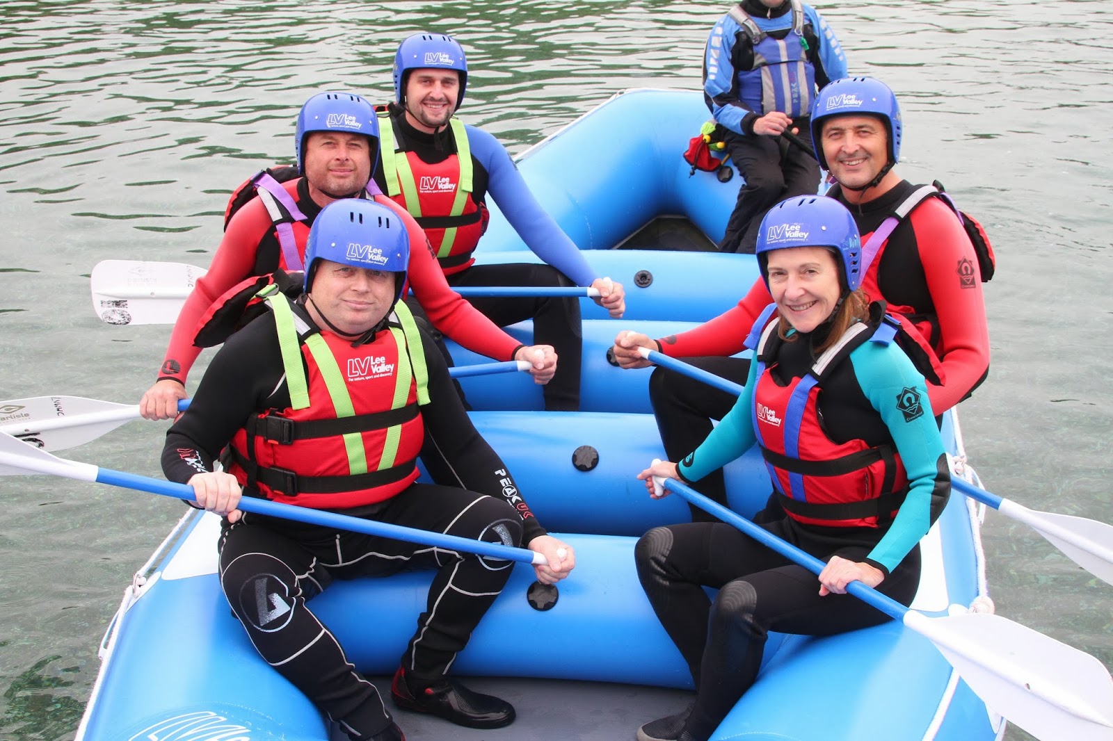
He probably won’t thank me for this but my brother turned 50 this year. To celebrate this (in) auspicious occasion his girlfriend Debbie brought Robin and myself (many, many thanks by the way) tickets to go rafting at the Olympic venue at Waltham Cross. This was great fun, so once again many thanks.

 Limbering up.

 Ready for action.

Action.


Thursday, August 8, 2013

Hawkins Hill – Red Rocks Loop

This is one of my favourite and most varied walks with great views up on the hills and equally great coastal scenery.

There are plenty of variations of the route but I usually take the Tip Track, which starts on Happy Valley Road and is about a 10-minute drive from Lyall Bay.

The track starts off steeply but the gradient decreases somewhat after about 10 minutes and from here it is a steady slog up to Hawkins Hill that takes me about an hour. Hawkins Hill at 495m is the highest point on the hills to the South of Wellington and has terrific views of the city and the South Island. Wellington is a breezy place at the best of times and Hawkins Hills exposed position overlooking the coast means that it is often ferociously windy which can make it a real challenge to actually make it up to the radar station situated on the summit. 

On the next section I initially retrace the same route but after about 10 minutes there is a junction where I pick up a track (signposted) which heads of to Red Rocks, which is situated on the South Coast. This part of the walk winds its way over the hills before dropping steeply down to the coast. The rocks here are indeed red but the areas main claim to fame is the Seal colony, which is situated there. At this point it is usually time for a brew up and some Seal spotting. From here it is a case of following the coast back before eventually arriving back at Happy Valley and then off to find the nearest café. Depending on how much Seal spotting you do the whole walk should take 3 to 4 hours.


 Trig point on top of Hawkins Hill.

 Looking toward Makara Wind Farm.

Mount Tapuaenuku (I think)

 The number of Seals present depends on the time of the year but they are at there most numerous over the winter months.

 They might look cute but they can move pretty fast and bite!

 I always give the Seals plenty of space and used a zoom to take pictures.

A Ferry heading off to the South Island.

This part of the coast is pretty rugged.