Thursday, January 6, 2011

Mount Hector Tramp

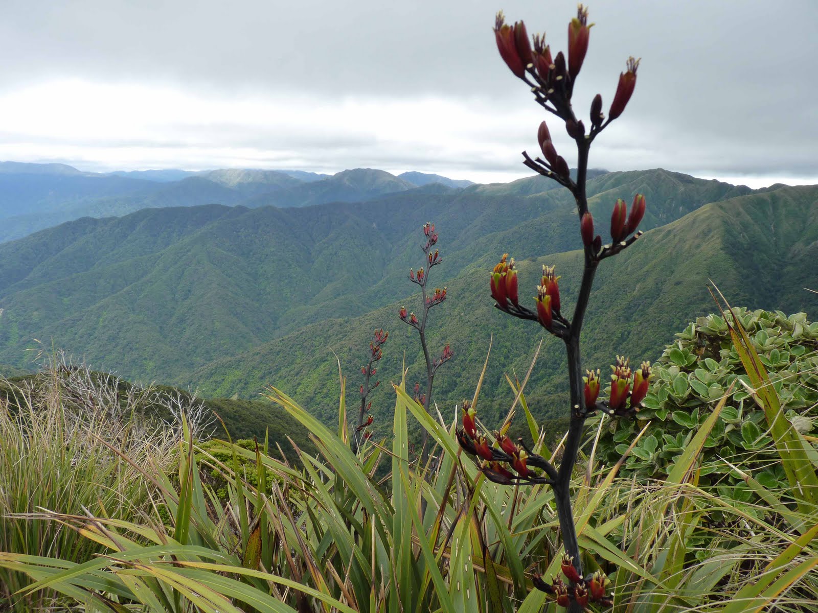
The object of this tramp was to climb Mount Hector (1529m) in the Tararua’s starting from Otaki Forks. We never quite made it all the way to the top as the weather started to deteriorate necessitating a tactical retreat. Here are the pictures anyway…


Fishing at Forest Park Lakes

There is very little coarse fishing in NZ and even less in the Wellington region. Forest Park Lakes is a lovely place to fish even it does entail an 80km drive. The venue is very pretty and isolated and the sort of place where you are unlikely to meet anyone else, which is just the way I like it. It was well worth the trip as I caught a very nice bag of Tench.


Xmas Camping Trip

This year we stuck the tent in the car and headed up the West coast of the North Island and just made it up as we went along. In the end we camped in the New Plymouth, Waitomo and Raglan areas.

This one was taken somewhere near Waitomo.

We walked through Waitomo Caves to check out the rock formations and glow worms. This is the entrance to the cave.

Rock formations - I took a few pictures of the glow worms, which alas did not come out.
The cave entrance from inside the cave.

Bridal Veil Falls - this were close to where we camped in the Raglan region.

I took some time out from camping and lattes and climbed Mt Karioi, which is situated just outside Raglan.

Taken from the top of Mt Karioi.

Northland Trip

After taking 9 years to get around to visiting the Far North this is the second time I have been there this year. The main aim of the trip was to visit my friend May and her family in Auckland, which we duly did. Neena and I then hired a car and headed up to Northland to have a look around.

Cape Reinga. This is where the Pacific Ocean and Tasman Sea meet.

Cape Reinga.

Cape Reinga - looking West.

Cape Reinga.

Rangitoto Island - lava tube.

Rangitoto Island - looking towards the summit.

I took a boat trip to the volcanic Rangitoto Island which is located a few miles offshore from Auckland.


Friday, September 10, 2010

Coldkiwi Rally 2010

It was the first weekend of September and for any self-respecting masochistic kiwi biker there is only one place to go – the Coldkiwi Rally.

The rally takes place every year about 10km from the town of Waiouru in the central North Island. Joining me for the torture this year were two friends, Neil and Steve.

The Coldkiwi rally is held in one of the coldest parts in the North Island and certainly lived up to its name this time around.

We rode up to Waiouru on Friday with the intention being to camp at the rally for the next two nights. The ride up was truly horrible with driving cold rain for most of the way. Neil’s bike got water into its electrics and broke down. It took us ages to sort this out and meant that it was very late by the time we got to Waiouru. None of us really fancied setting up the tents in the dark and the rain, so it was fortunate that Steve knew someone who lives at a nearby army base, and who was gracious enough to put us up for the night.

We woke up on Saturday morning to find that the weather had turned even colder and the town was covered in a blanket of snow. On top of that we had a 4hr power cut and also found out that Christchurch in the South Island had suffered a magnitude 7.1 earthquake. On this inauspicious note and after waiting an age for most of the snow to melt, we set of for the campsite.

It was a real pleasure to finally arrive at our destination, not least because the weather was now lovely and sunny, if not overly warm, but hey its not called the Coldkiwi rally for nothing!

The rest of the rally followed the usual formula of hill climbs, burn-outs, rock bands, burgers and beer, which is just fine by me. The rest of the trip was uneventful enough, though Neil did provide some additional entertainment by falling of his bike in the mud, a fate I only narrowly avoided.

It was a fun weekend away and I am sure we will be back for further punishment next year.

Saturday morning in Waiouru.


The roads were very slippery so we had plenty of time to walk around until the snow and ice had melted enough for us to safely get to the campsite.

Neil and Steve.

You know who.

We even had a firework display but, alas, no ceremonial "moped burning".

I took this picture of Mt Ruapehu from my tent.


Tuesday, August 3, 2010

Colonial Knob


Saturday dawned bright and clear and with the forecast of horrible weather on Sunday my friend Jenny and I decided to head out into the hills for a day walk.

I have been making a point recently of exploring the extensive range of hills that surround Wellington. This is an area I have overlooked in the past in favour of the higher and more rugged Tararua and Rimutku ranges. Big mistake it turns out, as the local hills offer a great deal with splendid views and lots of open areas on the hill tops courtesy of the various sheep and cattle farms that cover the area.

The plan for the day was to walk from Porirua to Khandallah via Colonial Knob (468m) and Mt Kaukau (445m).

The route started with a stiff climb of about 40mins up to Colonial Knob. From here we had expected the track to follow the hilltops, but instead it steadily dropped down before entering a large pine forest. The track at this point got rather slippery and muddy and was hard going, but we eventually came out onto a small road. By the way, we had left the map in the car so were very much making it up as we went along and as there were no signs at this point we headed off along the road in what we hoped was the right direction. It turned out it was, though more by luck than judgment. We had been walking along the road for about an hour when much to our surprise we came upon a horse riding school, which even more surprisingly had a café. A quick mochachino was in order and suitably revived we headed off again almost immediately picking up a track heading toward Mt Kau Kau. This was my favourite part of the journey with the best scenery and walking of the day. It also helped that I was back on familiar ground as I have climbed Mt Kaukau many times in the past, albeit not from this direction. An hour and a half and another stiff climb and descent later we reached Kandallah and the end of the trip.

A fair part of the walk was through pine forest or along the road, which is fairly unusual in this part of the world and at times was more reminiscent of the sort of walks I used to do in the UK. A pleasant surprise and a top trip.

Looking toward Colonial Knob.

A the top of Colonial Knob.

Mochachino and carrot cake heaven.


The weather started closing in towards the end of the walk. If you look closely you can just see the the bottom of the radio mast on the top of Mt Kaukau.

Wednesday, July 14, 2010

Day walk to Red Rocks (Seal haul-out area)

These pictures were taken on a day walk in the hills (and along the coast) close to where we live in Lyall Bay. The walk has an inauspicious start as it begins on a track close to the Happy Valley rubbish dump. As these places go it is not so bad, though at the end of the day a rubbish dump is still a rubbish dump. The rest of the area is very picturesque, with some fine views of the South Island.

Taken near the start of the walk looking back towards the rubbish dump, which mercifully is just out of view.
Along the tops looking back towards Lyall Bay.

If you look carefully you can see the snow capped inland and seaward Kaikoura ranges.

Looking towards Red Rocks.

After a steep descent we arrives at Red Rocks.